No products in the cart.
Developed by Jeppesen for your favorite style of boating, C-MAP 4D represents the latest evolution of electronic charting technology. C-MAP 4D combines our award-winning vector chart data with Dynamic Raster Charts for stunningly detailed 3D views and satellite imagery. Our innovative features include unique content and exclusive Value Added Data to enhance each cruising, fishing or sailing experience. C-MAP 4D truly is your all-in-one charting solution, compatible with select chartplotters from Furuno, Standard Horizon and Humminbird.
C-MAP 4D Wide and 4D Local charts provide a wealth of features that make navigation safer, fishing more productive and cruising more fun. The following features table shows the many ways C-MAP 4D can make your boating experience better and more efficient.
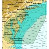
C-MAP 4D Local charts are an affordable option designed to exceed your most stringent cruising, sailing and fishing expectations. Don?t be fooled by the name ? these charts cover large areas of U.S., Canadian, and Mexican coastal waters, as well as the Bahamas, Great lakes and the St. Lawrence River. With a C-MAP 4D Local chart in a compatible OEM partner chartplotter, you can enjoy extended time on the water and seek adventure both near and far.






Reviews
There are no reviews yet.